- Corporate
- Our Solutions
-
Media
- Product Brochures
-
Press News
- Simsoft Participated in World Defense Show (WDS) 2026 in Riyadh
- Simsoft Showcased Next-Generation Simulation and Training Technologies at EDEX 2025
- “Gaming Panel in the Second Century” Sheds Light on the Digital Future
- We are on the Next Sosyal Platform!
- Simsoft at IDEF 2025: A Strong Future with Local Technology
- We Are Pleased to Announce
- We Have Secured Our Place Among Turkey's Top 500 IT Companies
- Our President Mr. Recep Tayyip Erdoğan Honored Us With His Visit To Our Stand During The EFES 2024 Exercise.
- TÜBİTAK BİLGEM Personnel visited our SIMMER New Generation Simulation Development, Training and Test Center
- SİMMER from SSB International Cooperation Department Personnel Visited Our Facility
- KTU Students visited our SIMMER - New Generation Simulator Production, Training and Test Center
- Opening Ceremony of our SIMMER Facility
- We are happy and proud to celebrate the 18th anniversary of our foundation!
- ASO 60th Foundation Year Awards "International Project" Award Won by Simsoft
- We Successfully Completed DIMDEX 2024
- SASAD New Office Visit
- CMMI Level3
- World Defense Show 2024 Exhibition Begins
- We Explained Our Simulation, Simulator and Augmented Reality Technologies to the Commanders of the Future
- Simsoft Receives the Award for the Female Entrepreneur Company with the Fastest Increase in Exports
- We were in Karachi Pakistan for IDEAS 2022
- Great Interest to Our Stand at SAHA EXPO 2022
- ICDDA 2022 - 5th Industrial Cooperation Days in Defense and Aerospace
- Let's Meet At ICDDA 2022
- Simsoft EFES Exercise in Exhibition Area
- We Celebrated Simsoft's 16th Foundation Anniversary at our new facility SIMMER!
- Youngsters with Down Syndrome went up to the Captain's Mansion!
- Simsoft Bridge Installation Completed at Sakarya University of Applied Sciences Maritime Vocational School
- DIMDEX and DSA 2022
- Simsoft is 16 Years Old!
- Two of our projects were approved under the TUBITAK TEYDEB 1501 Industrial R&D Projects Support Program
- Simsoft is again on the list of Service Exporters Association (HİB) Export Champions!
- Simsoft New Year Event 2022
- Saha EXPO 2021
- The 2021 class of the EY Turkey Entrepreneurial Women Leaders Program has been announced
- Simsoft Celebrates 15th Anniversary
- Simsoft Products in DMO Tekno Catalog
- Simsoft TUSIAD Digital Twin Project
- Simsoft is 15 years old!
- Simsoft Hacettepe Technopolis Branch Opened
- Simsoft is Once Again on Deloitte Technology Fast 500 EMEA List!
- Limatek System and Simsoft Join Forces!
- GDA 2019
- Serious Play Conference
- Turkish Lloyd Assurance to Bridge Simulator
- IDEF 2019
- Visit of Bangladesh Military Delegation
- INDO Defence Expo & Forum
- ICDDA 2018
- ADEX 2018
- GALAKSIM-3D Space Simulator exhibited at Teknofest İstanbul
- KADEX 2018
- DSA 2018
- 12th Anniversary of Simsoft
- Defence Turkey - Veysi İşler Interview
- Simsoft was awarded the ISO 27001:2013 Information Security Management System Certificate.
- Simsoft won "Best Serious Game" Award in Crystal Pixel with "Sınıfta" Game!
- GDA 2017
- Simsoft won "Best Mobile Game" Award in I / ITSEC 2017 with MyStartup Game!
- Simsoft became a “Serious Games Challenge” Finalist at I/ITSEC 2017 with MyStartup game
- Star Talents Program
- Simsoft in Asian Military Review Magazine
- USMOS Conference 2017
- Defense & Security 2017
- Yildiz Technical University (YAEM) 37th National Congress Training on Development of Simulation Technologies
- Simsoft has been reassessed as Maturity Level 3 under CMMI Dev v1.3.
- Simsoft Signs Two New Contract with Bangladesh Armed Forces
- Software Design Achievement Award from Aselsan to Simsoft
- Simsoft's 11'th Anniversary Event
- Simsoft at IDEF 2017
- 9-12 May 2017 to Discuss at IDEF 2017
- Simsoft at ATRAX 2016 Fair
- Simsoft, 3rd Land Systems Seminar
- Simsoft, at ICDDA event
- Simsoft at the ADEX 2016 Fair
- New Simulator Export from Simsoft
- Public Announcement from Simsoft
- Simsoft Participated in KADEX 2016 Exhibition
- Simsoft Awarded with Software Design Achievement Award
- Simsoft Participated in DSA 2016 Exhibition
- Simsoft Exports Another New Simulator
- Simsoft in the USA
- Visit of Bangladesh Delegation to Simsoft
- Simsoft at IDEF'15
- We're Serious In The Game!
- Simsoft is the Main Sponsor of SIMATHON 2015
- Simsoft Entered the New Year with Great Enthusiasm and Excitement
- Simsoft at the Road Traffic Safety Symposium and Exhibition
- Simsoft IDEF 2013'te...
- Teknoloji Ödülü Simsoft'ta...
- Simsoft at CEBIT 2012
- At Simsoft IDEAS 2012
- Simsoft at TÜHESFO
- Video Gallery
-
Human Resources
- Contact


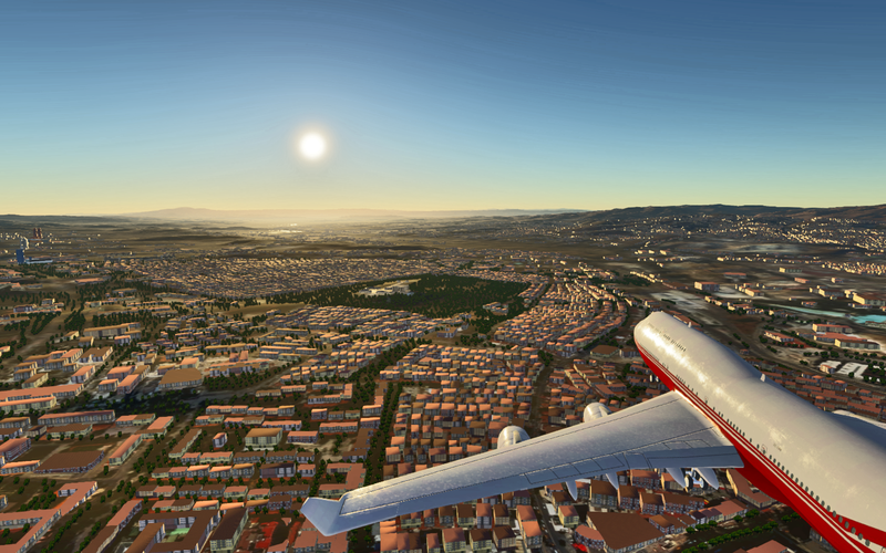
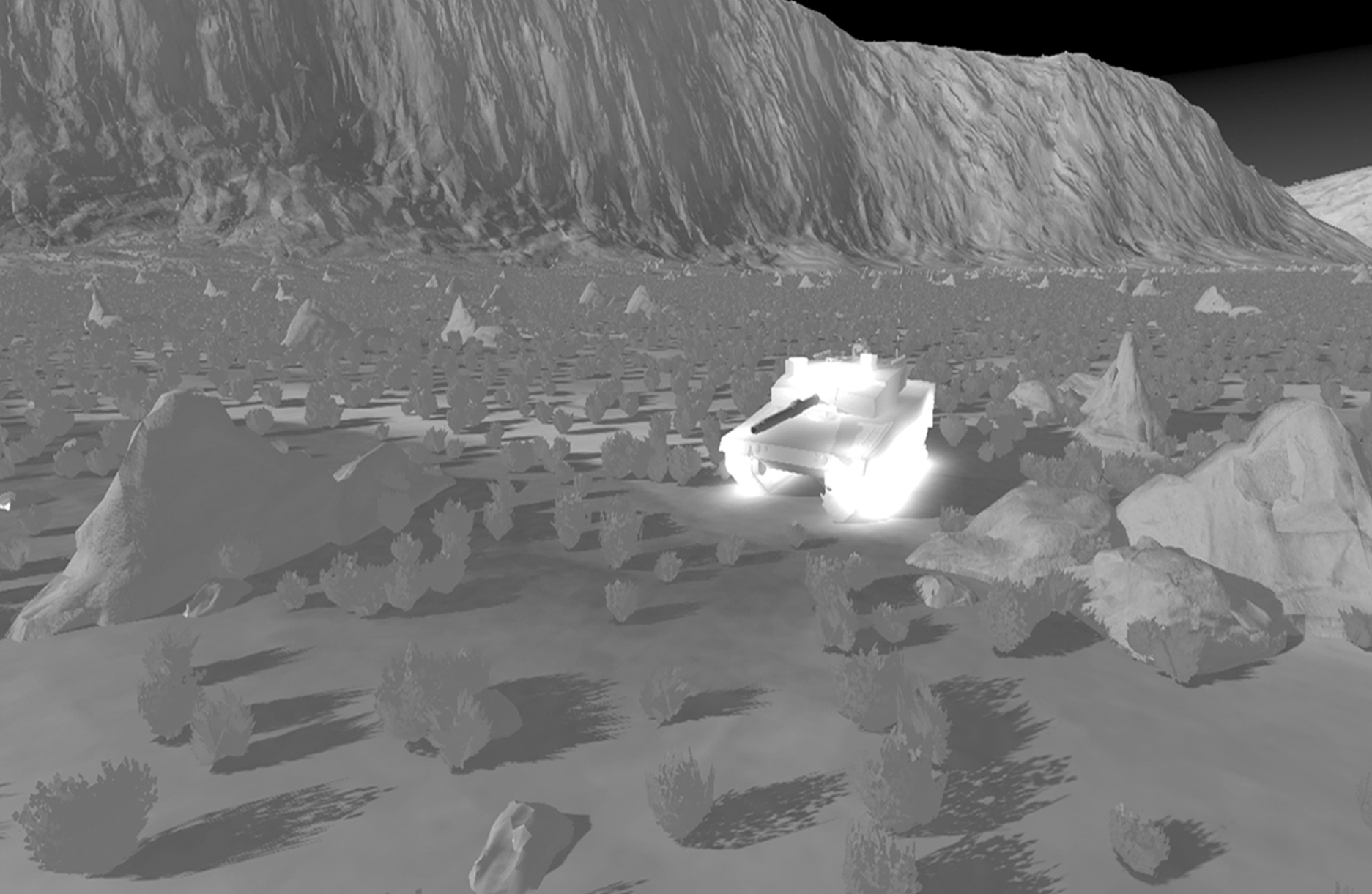
High Performance Image Generator (SimIG)
High Performance Image Generator (SimIG)
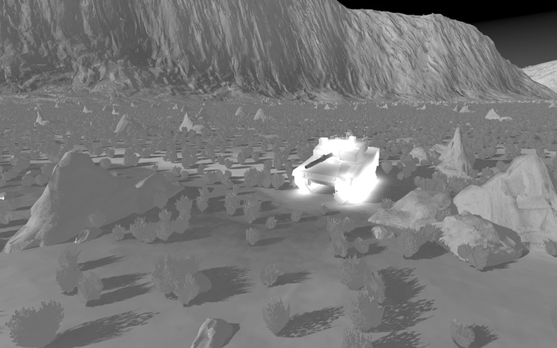
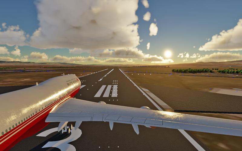
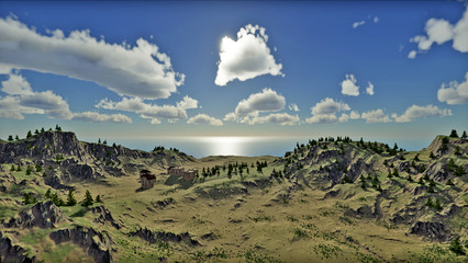
Simsoft stands out with its SimIG product in Image Generators that offer 3D realistic virtual environment capability for military / civil simulators. SimIG, which has the ability to visualize a large number of polygons in high quality and multi-channel, has the feature of Turkey's high-performance image generator.


Detailed Information
Photos
Videos
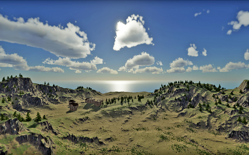
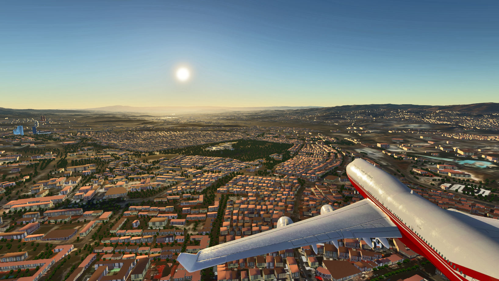
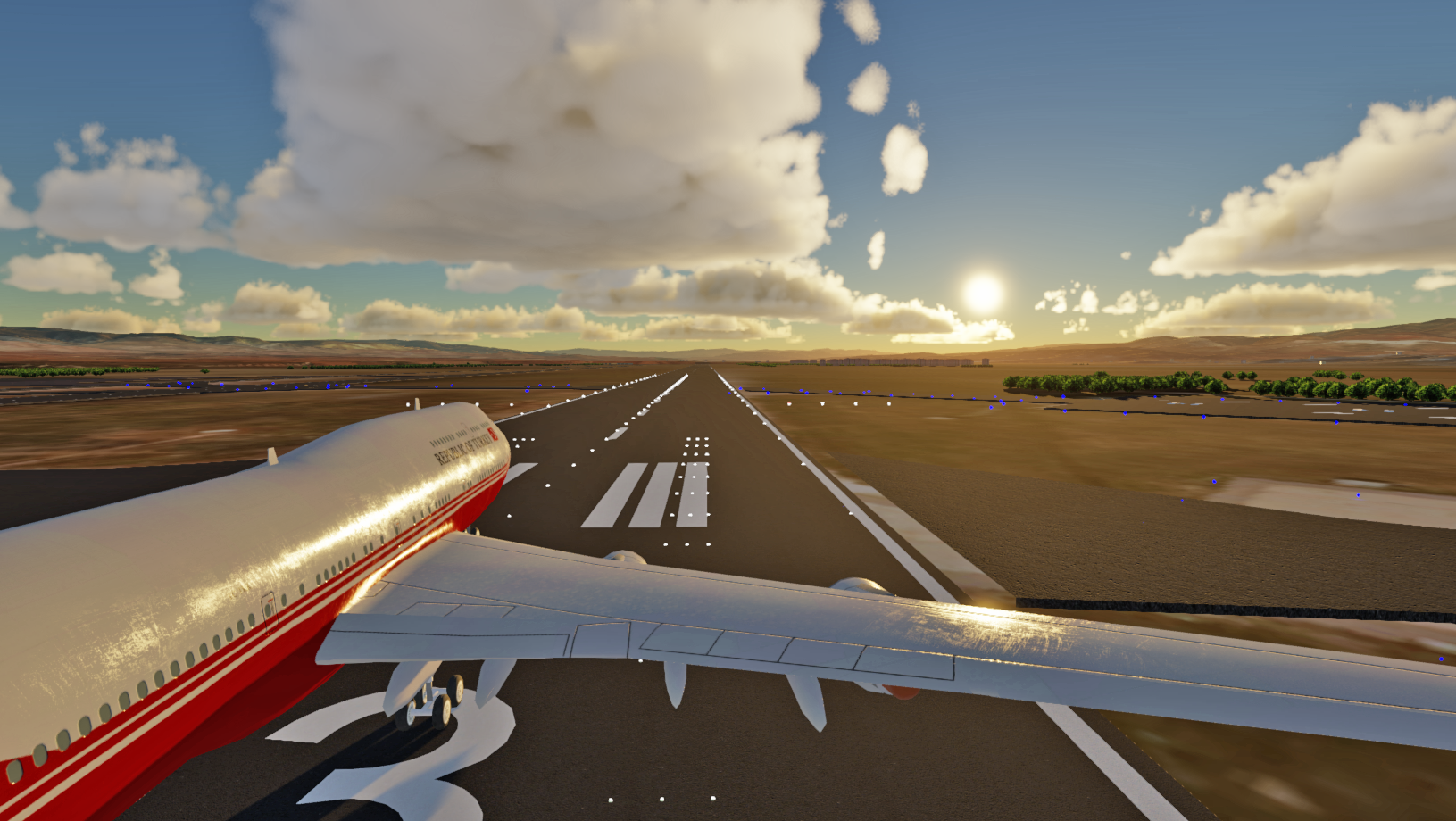
3D Visualization Capability (Sim3D)
- 60fps Achievement and 2M Polygon Visualization at 60fps
Lighting
- Dynamic Real-Time Lighting
- Multiple Light Source Support
- Lighting with Static Light Maps
- Shading
- Simulation of Environmental and Ambient Conditions
- Snow, Rain, Hail, Fog
- Volumetric Clouds
- Atmosphere Based on Ephemeris Model
- Sensor Simulation
- Night Vision (NVG)
- Thermal Camera
- Special Effects (Dust, Explosion, Smoke, Fire)
- Realistic Geometric Water Simulation
- GPU-Based Physics Capabilities
- Character Animation
- Programmable Artificial Intelligence Capabilities
- Widespread 3D Model Support such as OpenFlight, .ive, .3ds
- Parallel Visualization and Multi-Channel Support
- Sound Simulation
- Large Area Wide Terrain Visualization
- Optimizations (LOD, Culling, Paging)
- CIGI Support
Communication Capability (SimFramework)
- Distributed Architecture Based Infrastructure
- Expandable Simulation Architecture
- HLA Support
- High Performance Communication
- Various Communication Infrastructures (TCP/IP, UDP/IP)
- Data Compression
- Multicast Support
- 3D Model/Character/ Terrain/Texture Libraries
- Various High Resolution 3D Models
- LOD Support
- 3ds, .ive, .flt
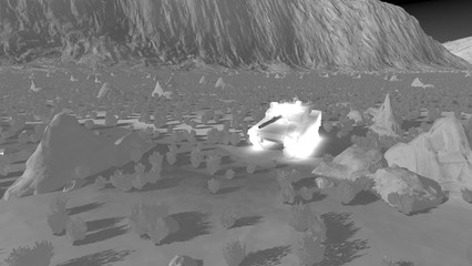
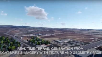
3D Database Creation Capability (SimTerrain)
- Geographic Data for the Whole World
- Raster Elevation and Sounding Data
- Satellite Overlays
- Layer-Based Data Management and Visualization
- Hiding Different Layers
- Adjusting their transparency
- Wide Format Support
- 3D Terrain - OpenFlight, DTED, ESRI® Shape Files, etc.
- Raster Maps - GeoTIFF, CADRG, .bmp, .png, .jpeg, etc.
- Vector Data - ESRI Shape Files, .dfd, etc.
- Automatic 3D Terrain Generation from Vector Data
- Creating Cultural Elements from Vector Data
- Adding Cultural Elements to the Land
- Adding Roads, Trees, Buildings, Rivers, etc.
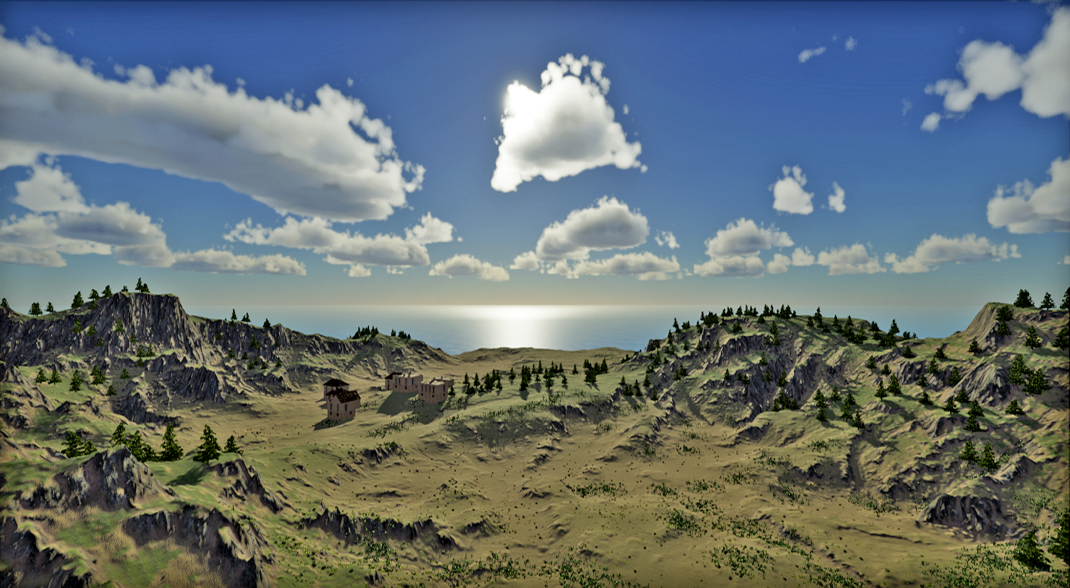
Advanced Visualization of Atmospheric Conditions
- Position of the Sun and Moon
- Layered and Voluminous Clouds
- Lighting Points According to the Stars
- Rain, Snow, Hail
- Various Fog Effects and Atmosphere Layers
Lighting
- Dynamic lighting that changes according to different times of the day
- Dynamic shading of objects
- Lighting with multiple light sources
Multi-Structured Techniques
- Normal map
- Shaded map
- Illuminated map
Character Animation
- Face animation
- Body animation
- Animation blending
- Adding hardware


